
GEOLOCATION DURING PHOTO DOCUMENTATION
How INSPECTOR saves GPS coordinates and capture address
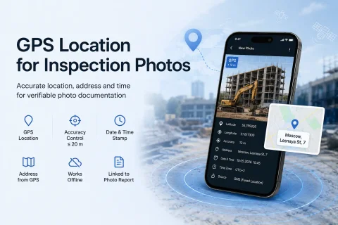
INSPECTOR helps automatically save GPS geolocation, address, date, and time during photo documentation of construction supervision, field service visits, logistics, and object inspections.
During capture, the app can save:
- latitude and longitude;
- location determination accuracy;
- capture address;
- photo date and time;
- time zone;
- coordinate link to the photo report;
- device and app data.